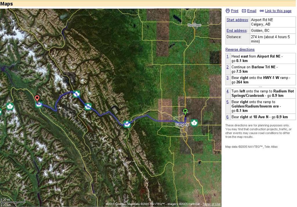
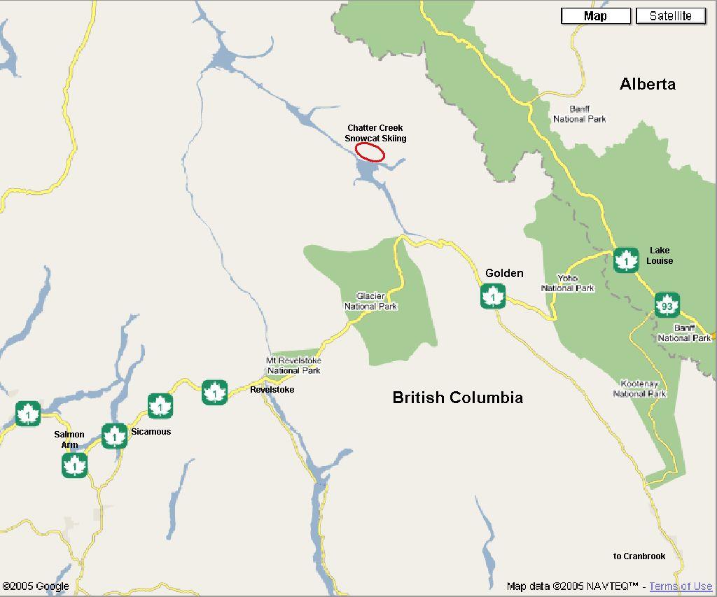
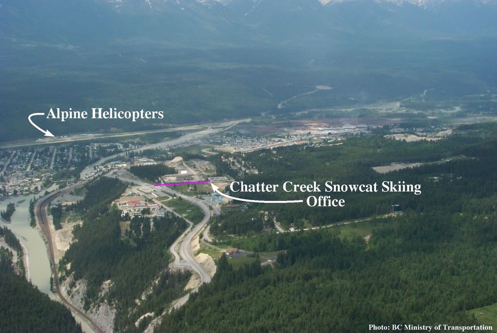
This map from the “
Google Maps” Web site shows the location of
Golden BC on the
TransCanada Highway (Route 1), between the towns of
Banff (and Lake Louise),to the east, and
Revelstoke, to the west. The nearest city is
Calgary, Alberta, which is the location of the nearest international airport.. Provincial highway 95 links Golden with
Cranbrook and the
USA (Spokane WA), to the south.
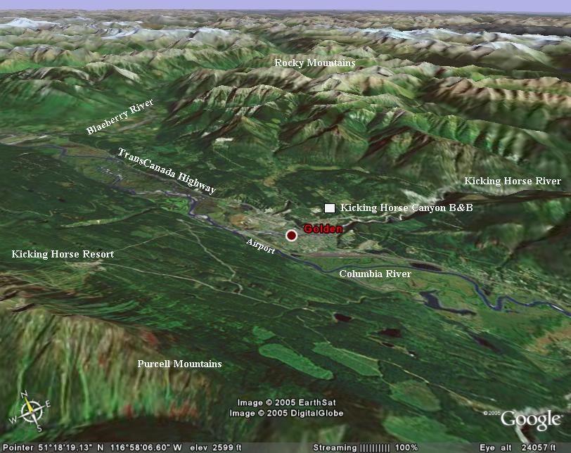
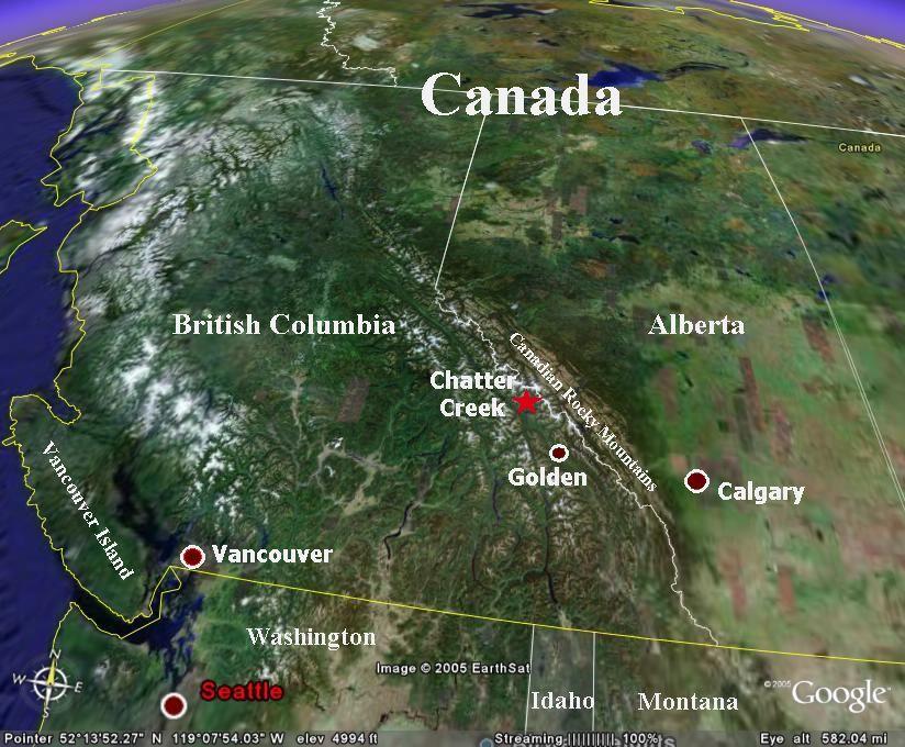
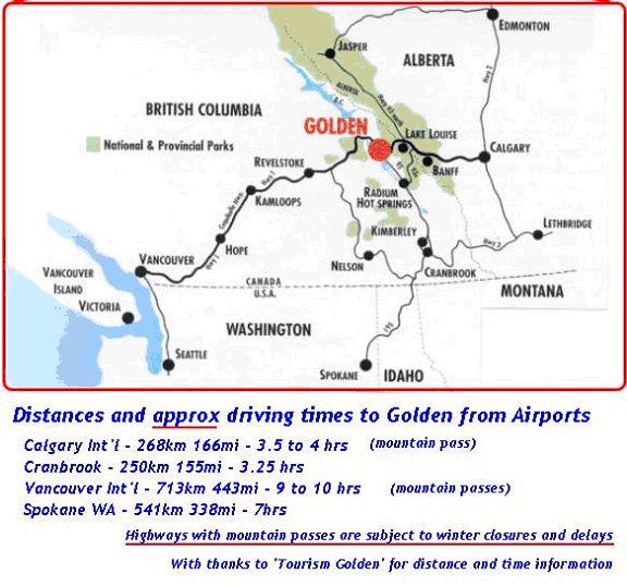
The Microsoft
MapPoint image to the right shows
Golden BC and the region of
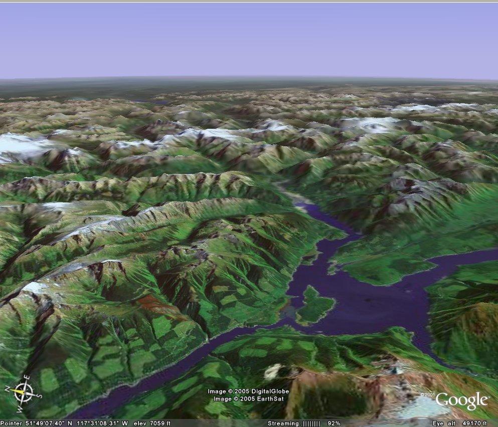
Kinbasket Lake, including Chatter Creek. The
Google Maps satellite image above it shows the
TransCanada highway between Sicamous and Lake Louise, and the Chatter Creek location, north of Golden.
Click on either image to enlarge it.
Scroll down for more
maps,
3-D Satellite images and
driving information.
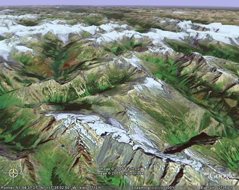
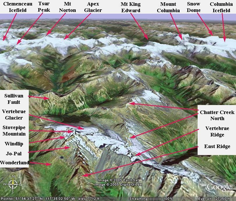
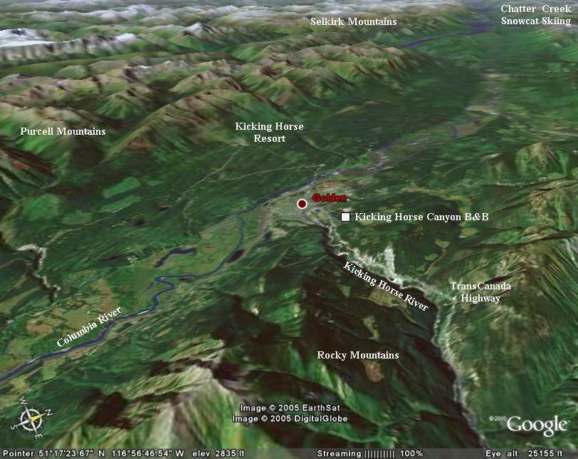
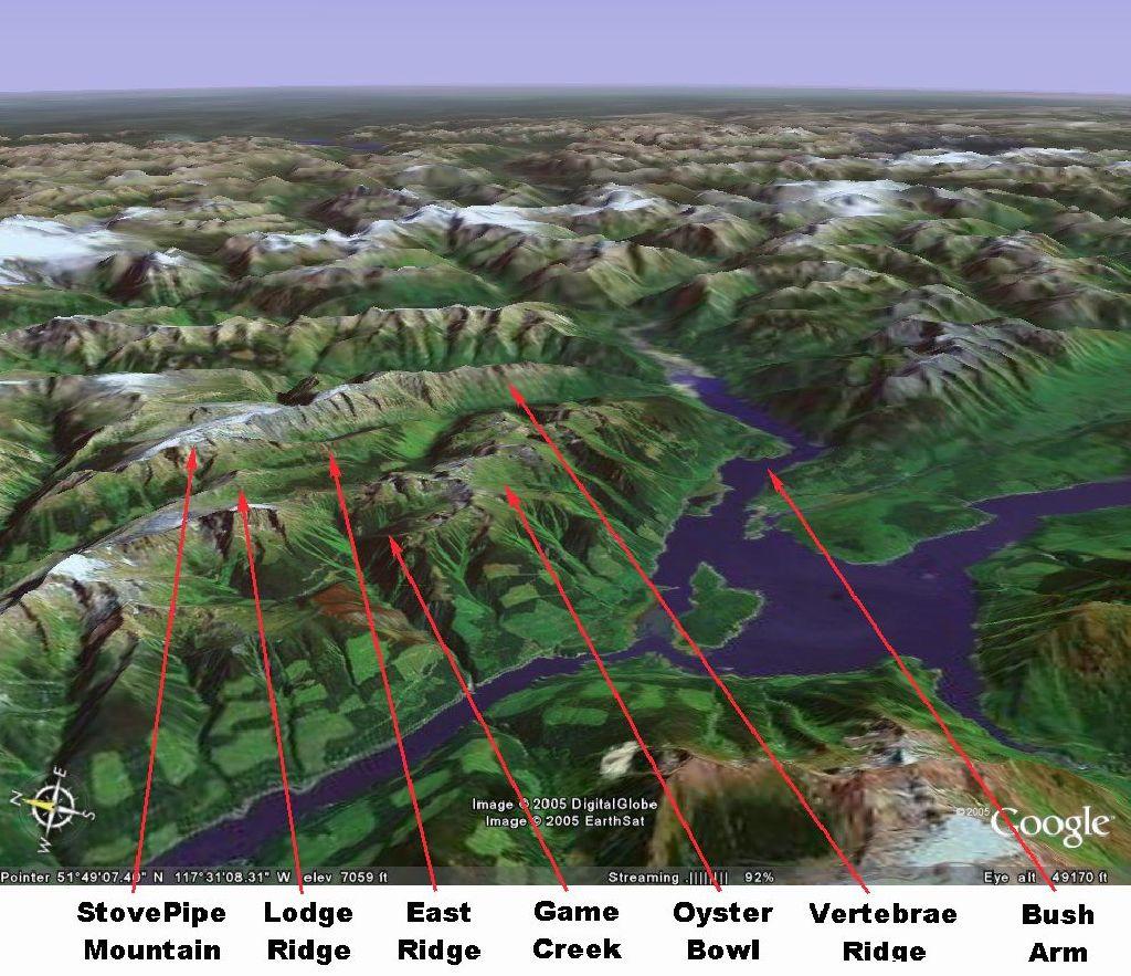
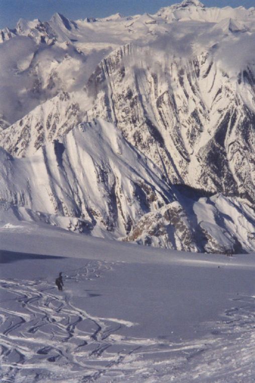
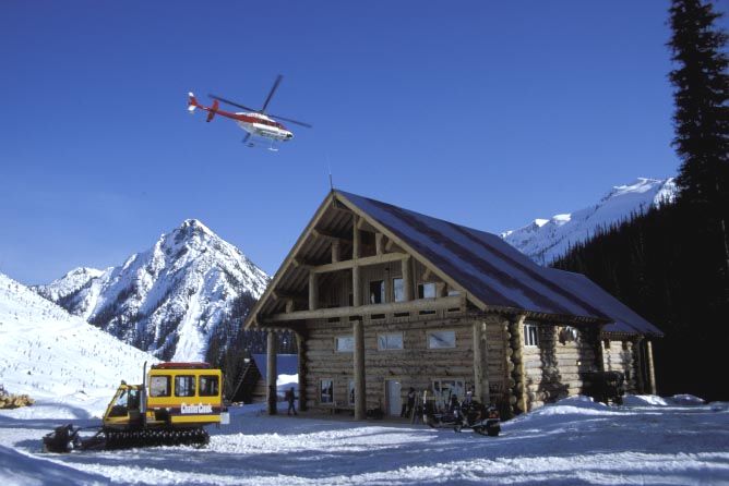
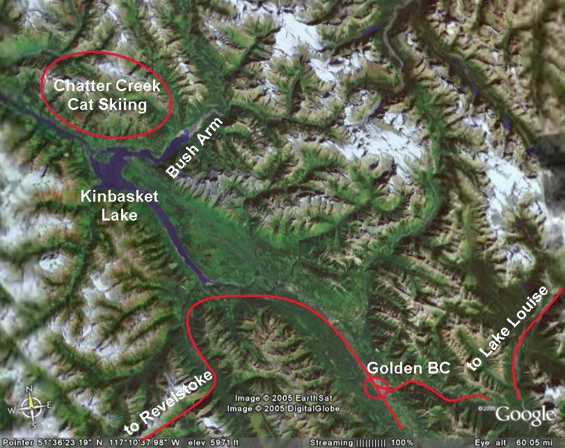
The
Chatter Creek snowcat skiing tenure is shown about 90 km. north of
Golden on the east side of
Kinbasket Lake and just north of Bush Arm (Bush River).
Banff National Park is to the west and
Jasper National Park is to the north. The
Adamant Range of the
Selkirk Mountains is to the west, across Kinbasket Lake. Parts of the
Kitchen Range,
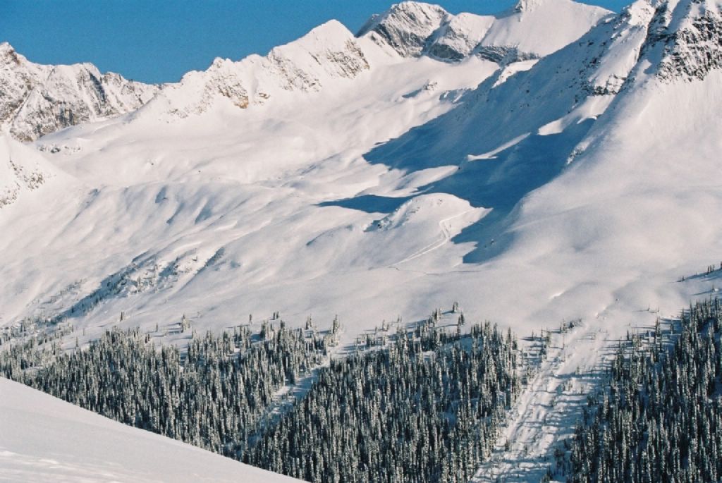
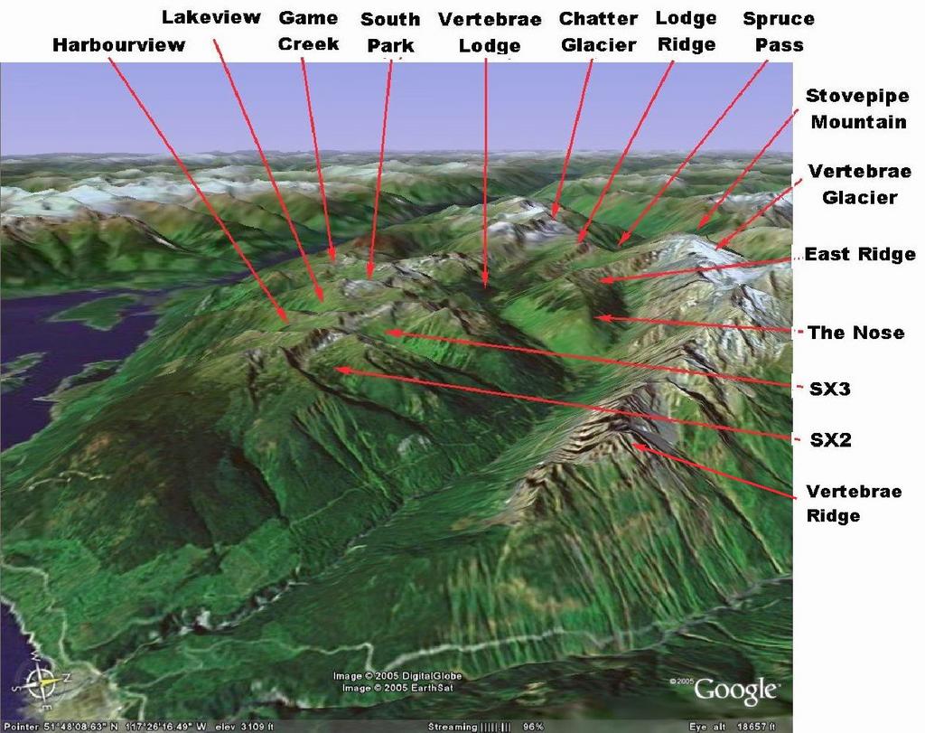
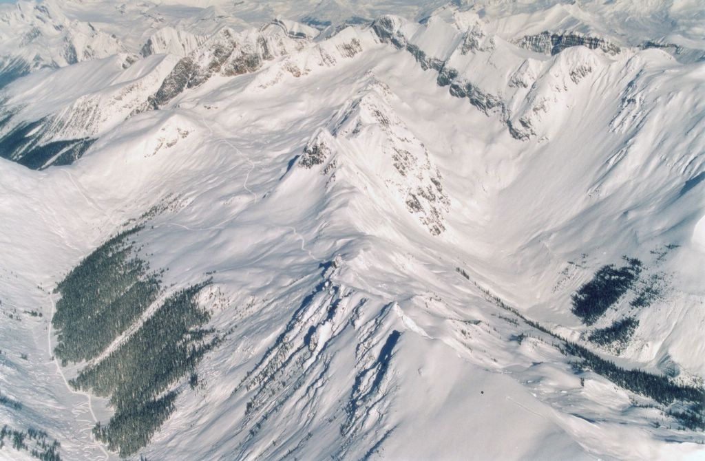
Vertebrae Ridge and
Stovepipe Mountain lie within the Chatter Creek cat skiing tenure.


.jpg)